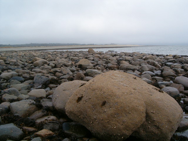
File:"Arnold's Rock", near Tyn y Morfa - geograph.org.uk - 1654357.jpg
From Wikimedia Commons, the free media repository
Jump to navigation
Jump to search
"Arnold's_Rock",_near_Tyn_y_Morfa_-_geograph.org.uk_-_1654357.jpg (640 × 480 pixels, file size: 70 KB, MIME type: image/jpeg)
File information
Structured data
Captions
Captions
Add a one-line explanation of what this file represents
Summary[edit]
| Description"Arnold's Rock", near Tyn y Morfa - geograph.org.uk - 1654357.jpg |
English: "Arnold's Rock", near Tyn y Morfa Looking east along the shore towards Criccieth. There is a story behind this rock and it derives from the 1960's when a boy who was on holiday and staying at Tyn y Morfa which at that time belonged to Mr Richards of Glanllynnau Farm. The boy (Arnold) was fishing from the beach and was cut off by the incoming tide which had come in round behind him (this part of the beach being raised, he hadn't noticed). He was forced to stand on this rock for an hour and a half until the tide receded and the water came up around his waist (he couldn't swim!). Hence this distinctive Rock became known as "Arnold's Rock" at least locally (the joke being if you are going fishing don't, whatever you do, fish from Arnold's Rock!). I doubt that this story is known much beyond Llanystumdwy and Chwilog and I doubt very much it is marked on any map, although it may well be documented somewhere locally because, as I understood it, the Criccieth Lifeboat was called out, but was not needed in the end. |
| Date | |
| Source | From geograph.org.uk |
| Author | Chris Wynne |
| Attribution (required by the license) InfoField | Chris Wynne / "Arnold's Rock", near Tyn y Morfa / |
InfoField | Chris Wynne / "Arnold's Rock", near Tyn y Morfa |
| Camera location | 52° 54′ 37″ N, 4° 17′ 09″ W | View this and other nearby images on: OpenStreetMap |
|---|
| Object location | 52° 54′ 38″ N, 4° 17′ 03″ W | View this and other nearby images on: OpenStreetMap |
|---|
Licensing[edit]

|
This image was taken from the Geograph project collection. See this photograph's page on the Geograph website for the photographer's contact details. The copyright on this image is owned by Chris Wynne and is licensed for reuse under the Creative Commons Attribution-ShareAlike 2.0 license.
|
This file is licensed under the Creative Commons Attribution-Share Alike 2.0 Generic license.
Attribution: Chris Wynne
- You are free:
- to share – to copy, distribute and transmit the work
- to remix – to adapt the work
- Under the following conditions:
- attribution – You must give appropriate credit, provide a link to the license, and indicate if changes were made. You may do so in any reasonable manner, but not in any way that suggests the licensor endorses you or your use.
- share alike – If you remix, transform, or build upon the material, you must distribute your contributions under the same or compatible license as the original.
File history
Click on a date/time to view the file as it appeared at that time.
| Date/Time | Thumbnail | Dimensions | User | Comment | |
|---|---|---|---|---|---|
| current | 20:13, 4 March 2011 |  | 640 × 480 (70 KB) | GeographBot (talk | contribs) | == {{int:filedesc}} == {{Information |description={{en|1="Arnold's Rock", near Tyn y Morfa Looking east along the shore towards Criccieth. There is a story behind this rock and it derives from the 1960's when a boy who was on holiday and staying at Tyn y |
You cannot overwrite this file.
File usage on Commons
There are no pages that use this file.
